Thassos Island, Greece
Lying close to the coast of Eastern Macedonia, Thassos is a Greek island, geographically part of the North Aegean Sea, but administratively part of the Kavala regional unit. It is the northernmost major Greek island, and 12th largest by area. Thasos is also the name of the largest town of the island (officially known as Limenas Thasou, “Port of Thasos”), situated at the northern side, opposite the mainland and about 10 kilometres (6 miles) from Keramoti. Thassos island is known from ancient times for its termae making it a climatic and balneoclimateric resort area.
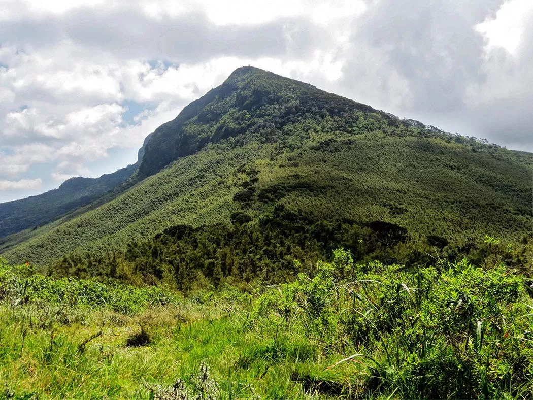
Thasos island is located in the northern Aegean sea approximately 7 km (4 mi) from the northern mainland and 20 kilometres (12 miles) south-east of Kavala, and is of generally rounded shape, without deep bays or significant peninsulas. The terrain is mountainous but not particularly rugged, rising gradually from coast to centre. The highest peak is Ypsario (Ipsario), at 1,205 metres (3,953 feet), somewhat east of centre. Pine forest covers much of the island’s eastern slopes.
Historically, the island’s population was chiefly engaged in agriculture and stockbreeding, and established villages inland, some of them connected via stairways (known as skalas) to harbors at the shore. The local population gradually migrated towards these shoreline settlements as tourism began to develop as an important source of income. Thus, there are several “paired villages” such as Maries–Skala Maries, with the former inland and the latter on the coast.
By far the most important economic activity is tourism. The main agricultural products on the island are honey, almonds, walnuts, olives(famously Throuba olives), and olive oil, as well as wine, sheep, goat herding, and fishing. Other industries are lumber and mining which includes lead, zinc, and marble, especially in the Panagia area where one of the mountains near the Thracian Sea has a large marble quarry. The marble quarries in the south (in the area of Aliki), now abandoned, were mined during ancient times.
Santorini, Greece
Santorini, is an island in the southern Aegean Sea, about 200 km (120 mi) southeast of Greece’s mainland. It is the largest island of a small, circular archipelago, which bears the same name and is the remnant of a volcanic caldera. It forms the southernmost member of the Cyclades group of islands, with an area of approximately 73 km2 (28 sq mi) and a 2011 census population of 15,550. The municipality of Santorini includes the inhabited islands of Santorini and Therasia and the uninhabited islands of Nea Kameni, Palaia Kameni, Aspronisi, and Christiana. The total land area is 90.623 km2(34.990 sq mi).Santorini is part of the Thira regional unit.
Santorini is essentially what remains after an enormous volcanic eruption that destroyed the earliest settlements on a formerly single island, and created the current geological caldera. A giant central, rectangular lagoon, which measures about 12 by 7 km (7.5 by 4.3 mi), is surrounded by 300 m (980 ft) high, steep cliffs on three sides. The main island slopes downward to the Aegean Sea. On the fourth side, the lagoon is separated from the sea by another much smaller island called Therasia; the lagoon is connected to the sea in two places, in the northwest and southwest. The depth of the caldera, at 400m, makes it impossible for any but the largest ships to anchor anywhere in the protected bay; there is also a fisherman’s harbour at Vlychada, on the southwestern coast. The island’s principal port is Athinios. The capital, Fira, clings to the top of the cliff looking down on the lagoon. The volcanic rocks present from the prior eruptions feature olivine, and have a small presence of hornblende.
Rhodes, Greece.
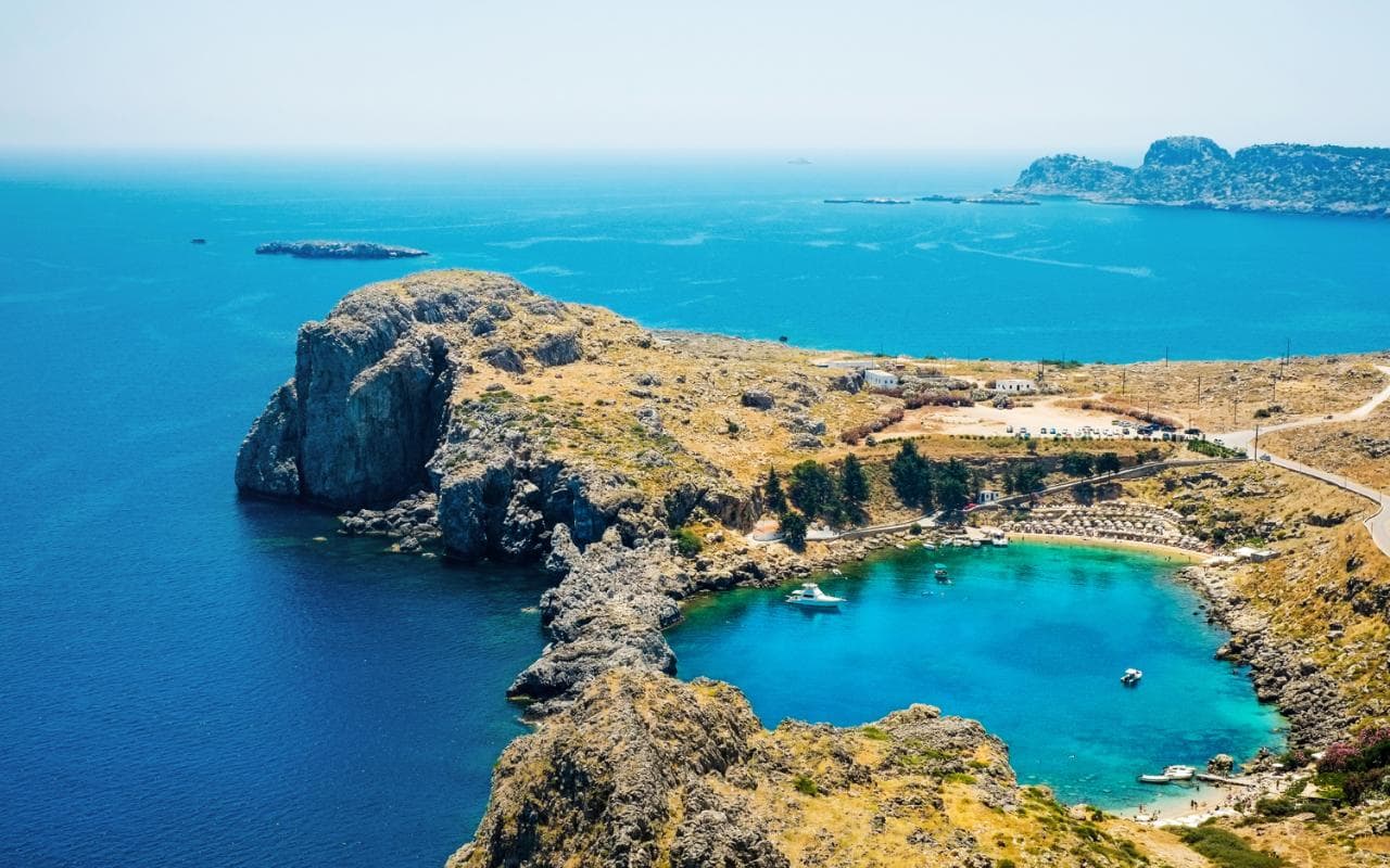
Rhodes is the largest of the Dodecanese islands of Greece in terms of land area and also the island group’s historical capital. Administratively the island forms a separate municipality within the Rhodes regional unit, which is part of the South Aegean administrative region. The principal town of the island and seat of the municipality is Rhodes. The city of Rhodes had 50,636 inhabitants in 2011. It is located northeast of Crete, southeast of Athens and just off the Anatolian coast of Turkey.
The island of Rhodes is shaped like a spearhead, 79.7 km (49.5 mi) long and 38 km (24 mi) wide, with a total area of approximately 1,400 square kilometres (541 sq mi) and a coastline of approximately 220 km (137 mi). Limestone is the main bedrock.The city of Rhodes is located at the northern tip of the island, as well as the site of the ancient and modern commercial harbours. The main air gateway (Diagoras International Airport, IATA code: RHO) is located 14 km (9 mi) to the southwest of the city in Paradisi. The road network radiates from the city along the east and west coasts.
Outside of the city of Rhodes, the island is dotted with small villages and spa resorts, among them Faliraki, Lindos, Kremasti, Haraki, Pefkos, Archangelos, Afantou, Ixia, Koskinou, Embona (Attavyros), Paradisi, and Trianta (Ialysos). There are mineral-rich spring water (and sometimes sea water) used to give medicinal baths and the spa resorts offer various health treatments.
Rhodes is situated 363 km (226 mi) east-south-east from the Greek mainland, and 18 km (11 mi) from the southern shore of Turkey.
Rhodes has a hot-summer Mediterranean climate.
Crete, Greece.
Crete is the largest and most populous of the Greek islands, the 88th largest island in the world and the fifth largest island in the Mediterranean Sea, after Sicily, Sardinia, Cyprus, and Corsica. Crete and a number of surrounding islands and islets constitute the region of Crete (Greek: Περιφέρεια Κρήτης), one of the 13 top-level administrative units of Greece.
A large number of islands, islets, and rocks hug the coast of Crete. Many are visited by tourists, some are only visited by archaeologists and biologists. Some are environmentally protected. A small sample of the islands includes:
- Gramvousa(Kissamos, Chania) the pirate island opposite the Balo lagoon
- Elafonisi(Chania), which commemorates a shipwreck and an Ottoman massacre
- Chrysiisland (Ierapetra, Lasithi), which hosts the largest natural Lebanon cedar forest in Europe
- Paximadiaisland (Agia Galini, Rethymno) where the god Apollo and the goddess Artemis were born
- The Venetian fort and leper colony at Spinalongaopposite the beach and shallow waters of Elounda (Agios Nikolaos, Lasithi)
- Dionysadesislands which are in an environmentally protected region together the Palm Beach Forest of Vai in the municipality of Sitia, Lasithi
Off the south coast, the island of Gavdos is located 26 nautical miles (48 km) south of Hora Sfakion and is the southernmost point of Europe.
Crete straddles two climatic zones, the Mediterranean and the North African, mainly falling within the former. As such, the climate in Crete is primarily Mediterranean. The atmosphere can be quite humid, depending on the proximity to the sea, while winter is fairly mild. Snowfall is common on the mountains between November and May, but rare in the low-lying areas. While some mountain tops are snow-capped for most of the year, near the coast snow only stays on the ground for a few minutes or hours. However, a truly exceptional cold snap swept the island in February 2004, during which period the whole island was blanketed with snow. During the Cretan summer, average temperatures reach the high 20s-low 30s Celsius (mid 80s to mid 90s Fahrenheit), with maxima touching the upper 30s-mid 40s.
The south coast, including the Mesara Plain and Asterousia Mountains, falls in the North African climatic zone, and thus enjoys significantly more sunny days and high temperatures throughout the year. There, date palms bear fruit, and swallows remain year-round rather than migrate to Africa. The fertile region around Ierapetra, on the southeastern corner of the island, is renowned for its exceptional year-round agricultural production, with all kinds of summer vegetables and fruit produced in greenhouses throughout the winter.[17] Western Crete (Chania province) receives more rain and is more erosive compared to the Eastern part of Crete.
Kindly note: We considerately advocate for M-Pesa payment for your safari using our TILL NUMBER.